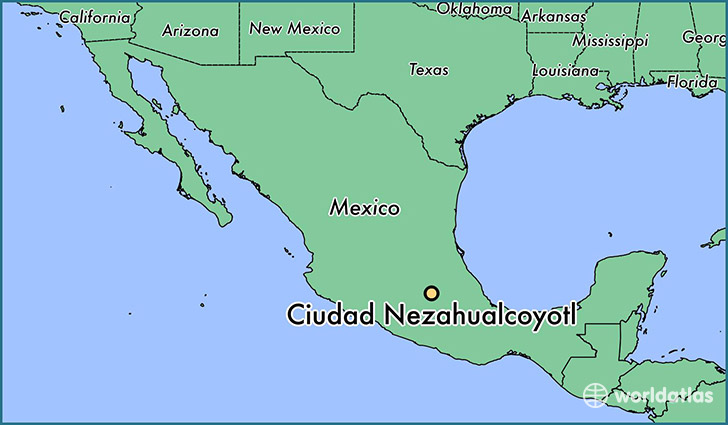
Map of Ciudad Nezahualcóyotl- Mexico

Ciudad Nezahualcóyotl, or more commonly Ciudad Neza, is a city and municipality of State of Mexico adjacent to the northeast corner of Mexico City: it is thus part of the Mexico City Metropolitan Area. It was named after Nezahualcoyotl, the Acolhua poet and king of nearby Texcoco, and was built on the drained bed of Lake Texcoco. The name Nezahualcóyotl comes from Nahuatl, meaning “fasting coyote.”
Until the 20th century, the land on which Ciudad Neza sits was under Lake Texcoco and uninhabited. Successful draining of the lake in the early 20th century created new land, which the government eventually sold into private hands. However, public services such as adequate potable water, electricity and sewerage were lacking until after the area was made an independent municipality in 1963. Today Ciudad Neza is a sprawling city of over one million entirely with modern buildings.
As of 2006, Nezahualcóyotl included part of the world’s largest mega-slum, along with Chalco and Izta. Most of its population is poor and have migrated from other parts of Mexico. It also has a very high crime rate, in part due to “cholos” or gangs formed since the 1990s based on gang models in the United States, especially Los Angeles. Since the 2000s, a significant number of natives of this city have immigrated to the United States, mostly settling in New York. This has led to a new Mexican subculture in the area.
The city and municipality is named after the Aztec King Nezahualcóyotl. The entity has an Aztec glyph as well as a coat of arms. The glyph depicts the head of a coyote, tongue outside the mouth with a collar or necklace as a symbol of royalty. It was one of the ways of depicting the Aztec king. The current coat of arms, which includes the glyph, was authorized by the municipality in the 1990s. The municipality comprises its own intrastate region, Region IX (Mexico State).
Population: 1 199 931 (2017)
Language: Spanish
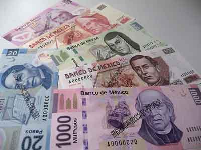
Currency: Peso (MXN)

History
Nezahualcoyotl, for whom the city and municipality were named, was the lord of Texcoco, one of the allies of the Aztec Triple Alliance. Texcoco dominated the area in which the modern municipality stands; however the land on which Ciudad Neza stands was under Lake Texcoco until the 20th century. Drainage of the interconnected lakes of the Valley of Mexico began in the early colonial period. The first major drainage project was begun in 1590, with the aim of eliminating the chronic flooding that plagued Mexico City. By the time of the Mexican War of Independence, flooding was still a problem in the Mexico City area, and at that time a project was begun to drain Lake Texcoco directly. The Lake Texcoco area was declared federal property in 1912, after which efforts to completely drain the lake commenced which continued until the 1930s. Starting in 1917 under Venustiano Carranza, efforts to determine legal ownership of lands that began to appear due to the drainage of the lake were undertaken. Most of this land was declared federal property to be sold. In 1933, the Mexico City–Puebla highway was built through this area. The first settlements in what is now the municipality were extensions of the municipalities of Chimalhuacán, La Paz and Ecatepec.
The area was known for a bird species called the chichicuilote-atziztizuilotl, which inhabited the lakes and ponds of the Valley of Mexico. Today it is nearly extinct. The center of the city had an area that specialized in the sale of the bird, both alive and cooked.
These initial settlements were without infrastructure or public services, and efforts to procure these began in the 1940s. In 1945 the Xochiaca dam and the Tequixquiac tunnel were built, the diversion of potable water allowed for the creation of the first formal neighborhoods of Juárez Pantitlán, México and El Sol. By 1949, the area had 2,000 inhabitants. In the 1950s the population of the area grew quickly as people from various parts of Mexico immigrated to the Mexico City area in search of opportunity. This grew to 40,000 by 1954, despite of the lack of other services such as electricity. The area gained more formal administrative status from the state of Mexico in the 1950s as it grew, but by 1959, a group representing the now-33 neighborhoods of the area protested the lack of services, which still included sufficient potable water.
In 1960, the idea emerged to separate this area from the municipality of Chimalhuacán in order to create a new municipality. By this time, the area had a population of 80,000. This idea culminated into the creation of the municipality of Nezahualcóyotl on 3 April 1963 by the state legislature, with Jorge Sáenza Gómez Knoth as the first municipal president.
Conversion of the area into a municipality helped greatly in getting water, pavement, sewer and streetlights in the 1960s and 1970s. However, the sale of land here was legally complicated due to problems in land title. This began to be regulated in the mid-1970s and would continue through the 1980s and into part of the 1990s.
By the early 1980s, major public buildings such as hospitals, the municipal palace, schools, libraries and the Museum of Archeology had been built. The Xochiaca area had become a landfill with a sports facility built along its edge.
The city grew quickly during the 1980s with new neighborhoods, shopping centers and other urban areas built. It became necessary to have a municipal committee dedicated to the control of urban growth.
In the 1990s the Ciudad Deportivo (Sports City) and the Universidad Tecnológica de Nezahualcóyotl were established. The population surpassed one million by 1995.
The city has produced a number of athletes, such as Humberto “La Chiquita” González and Graciela Hernández, the first of many wheelchair basketball gold medalists in the Pan American Games.
The city
The city is looked down upon by the residents of Mexico City proper, calling it “mi-Nezota” or “Neza York,” which refers to its sprawling size, and urban atmosphere devoid of the colonial structures in the center of town. Trash collection is still done by donkey cart in a number of areas of the city. The city has one of the highest crime rates in the State of Mexico.
However, the city is also home of the Orquesta Sinfónica Infantil y Banda Sinfónica de Nezahualcóyotl (“Junior Symphony Orchestra and Symphony Band of Nezahualcóyotl”), created in 1998. It is composed of 45 members ranging in age from 6 to 17 years. It is the only organization of its type in the State of Mexico. It has won various awards, including the “Premio estatal de la juventud 2002” (State Youth Prize of 2002). The orchestra has performed over 200 times, most of these concerts outside of the city itself. It is directed by Roberto Sánchez Chavez.
Cholos
To be a “cholo” is to be a part of a youth subculture associated with drugs and gangs which is strongly associated with Ciudad Neza. The word cholo, as used in various Latin American countries, referred to a person of mixed race (mestizo) from the lower classes. The origin of the cholo culture stems from the “pachuco” culture of the United States in the 1940s among the Hispanics there, which eventually morphed into the gangs that populate cities such as Los Angeles. The phenomenon of gangs came to Mexico from the U.S. in the 1980s. The first Mexican cholo groups came about in the 1990s, and were called by various names, such as “barrios,” “clickas” and “gangas.” Many of these groups were formed by youths who had spent time in the United States and returned with a different identity. Most cholos are youths between 13 and 25 years old who generally do not finish school beyond the eighth grade. These groups mimic the organization of gangs found in the United States, especially California. Cholos have their own style of dress and speech. They are known for hand signals, tattoos and graffiti. They are also involved in the use and sale of drugs, especially marijuana. Groups of cholos control various territories in the city. Most of the violence among these groups is over territory. Some of the better known cholo gangs in Neza are “41 Street,” “DK13,” “Cobras 13,” “Los Sur 13,” “Cobras 38,” “Los Mexican,” “Los de la 33,” “La 14” and the “Sur Kings.”
The former municipal president, Luis Sánchez, states that this kind of activity is waning and claims only two cholo groups are true active gangs. The rest are imitations of the lifestyle as a type of counterculture. He also states that no more than 500 youths belong to the gangs which have been identified by the authorities. Other sources state that this is not true and more than 100 groups operate in the city with many more members.
Transportation
Mexico City Metro Line B Buenavista-Ciudad Azteca:Nezahualcóyotl, Impulsora, Río de los Remedios
Mexibus Line 3 Chimalhuacán-Pantitlán:Las Torres, Bordo de Xochiaca, Rancho Grande, Las Mañanitas, Rayito del Sol, General Vicente Villada, El Castillito, Sor Juana Ines de la Cruz, Palacio Municipal, Adolfo López Mateos, Lago de Chapala, Nezahualcóyotl, Virgencitas, Vicente Riva Palacio, Maravillas, El Barquito


